|
|
![]() |
|
|
|
|
|
|
|
![]() |
![]() |
![]() |
![]() |
![]() |
![]() |
![]() |
![]() |
![]() |
![]() |
![]() |
![]() |
![]() |
![]() |
![]() |
![]() |
![]() |
![]()  |
|
|
|
|
|
|
|
|
| |
| © Laurie Block Spigel 2005 – 2012 |
|
Seven Things to Do With Maps
Maps are not just about geography and the earth's terrain. They are an integral part of understanding everything from world political history to adventures of heroic figures both real and fictional. The skills developed in map reading include: planning, orienteering and keeping a sense of direction, understanding and computing distance, using a map legend like a code, and gaining additional perspective on the world. Maps tell stories!
Here are seven things for kids to do with maps:
- Children age three to eight will enjoy making a map of their block, or of their immediate neighborhood- any place they know well. First take a walk around the area with a sketch pad and pencil to make sketches and take notes. The map can be drawn as an aerial diagram, or as a front view of the buildings. When you are done, mark an arrow to indicate the direction of north. If you like, you can create your own map legend. You can create symbols for: pizza restaurants, subway stations and bus stops, the library, etc.
A great example of a front view of a local neighborhood is Romare Bearden's The Block, done in collage. This great work of art hangs in the Metropolitan Museum in NYC. Take a close-up look on-line. For kids, Let's Walk the Block.
Older kids can make a more complicated guide to their neighborhood, playground, mall, or park, or perhaps a map of a larger area that could include their home and their friends' or grandparents' homes.
- When you take a subway or bus to your destination, ask your child to use the subway or bus map to trace your route with a colored marker or highlighter pen. Marking and mapping your journey as you take it, gives you a birds-eye perspective at the same time as you absorb other views. You have to look out the window to see where you are and where you're going, and then look at an aerial view to trace it. Each child can each have his or her own map (especially since bus and subway maps are free), and their own marker. You can do this whenever you travel, whether by car, plane, train, etc.
- Whenever you go to a zoo or museum, get a map for each person. When you are done with your visit, mark every place you went. Add one-word comments on the map about the things you saw in the places where you saw them. Many museums have special children's maps. You can take an extra one home, unused, for a scrapbook, or to turn into a bookcover, or to include in a work of collage art.
- Put a map on the wall, either of the USA or of the world. Find postcards, quotations, poems, etc., that are from various places on that map, and put them on the wall around the map. Connect each one to its corresponding place with a piece of yarn and tape or a tack or pin. Ask your friends who travel to mail you postcards and add them to the wall. When you read stories by authors from different places, use the wall map to mark those places with colored stickers.
- Go to the library and find short stories or poems about the USA, such as: My America: A Poetry Atlas of the United States, by Lee Bennett Hopkins. As you learn about a state or travel to a place, read poems about those places. For NYC poetry, try: Crossing Brooklyn Ferry, by Walt Whitman, Street Music, by Arnold Adoff, The Weary Blues, by Langston Hughes, and City Trees, by Edna St. Vincent Millay (http://www.beautyofnyc.org/Millay-CityTrees.htm). Find a location on a city map that corresponds to the poem, and perhaps the street where the poet lived. Add these poems next to your wall map. As you find new poems about places, replace the ones that have been up for a while.
- Create an imaginary map of an imaginary place. I have always loved books with maps on the inside cover, like Winnie the Pooh. Robert Louis Stevenson is said to have imagined his story Treasure Island, by first drawing a map of the place.
- Take a map of any place you know well, and write over the place names using your own associations. The Hudson River could be renamed River of Dreams or Palisades Trail River (especially if you have walked that trail). Broadway might become Mary Poppins Avenue or Lion King Way. Lincoln Center could be renamed Dancer's Heaven or Aria Place. The more personal the name, the better. You use a small font on the computer and tape or glue the new names over those already on the map. When you are finished it can look like a real map, but it will be a reflection of your memories and personal story.
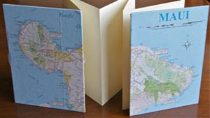
City bus and subway maps are free, and AAA members can get maps for free. Most tourist bureaus and visitor's centers have free maps. I have gone to the Irish or British Tourist Bureaus just to get maps! Most interstate highways have visitor centers at state borders where you can get state maps for the asking, and brochures with local maps too. When your maps get old and dated, don't throw them away. Instead, turn them into projects! In Laurie's class on The Geography of Poetry, students used maps to cover their books of poems. See the books and the Class.
Books about maps for young children:
- Mapping Penny's World
 , by Loreen Leedy. Penny is a dog, and the maps are of places where she hangs out (bedroom, neighborhood, park, etc.). Amusing and informative , by Loreen Leedy. Penny is a dog, and the maps are of places where she hangs out (bedroom, neighborhood, park, etc.). Amusing and informative
- Me on the Map
 , by Joan Sweeney, shows maps from small places (a child's room, house, street, etc.) to larger places (state, country, world), from a child's point of view, beautifully illustrated , by Joan Sweeney, shows maps from small places (a child's room, house, street, etc.) to larger places (state, country, world), from a child's point of view, beautifully illustrated
- My Map Book
 , by Sara Fanelli, a visual and conceptual array of maps without narrative, including the maps of a family, a day, a dog, and a child's heart , by Sara Fanelli, a visual and conceptual array of maps without narrative, including the maps of a family, a day, a dog, and a child's heart
- As the Crow Flies: A First Book of Maps
 , by Gail Hartman and Harvey Stevenson, shows the maps that different animals might use , by Gail Hartman and Harvey Stevenson, shows the maps that different animals might use
- Follow That Map!: A First Book of Mapping Skills
 , by Scot Ritchie, introduces the compass rose, latitude and longitude, scale indicators, and more , by Scot Ritchie, introduces the compass rose, latitude and longitude, scale indicators, and more
- There's a Map on My Lap!: All About Maps
 (Cat in the Hat's Learning Library), by Tish Rabe, written in typical Dr. Seuss rhyming style, including hands-on map activities (Cat in the Hat's Learning Library), by Tish Rabe, written in typical Dr. Seuss rhyming style, including hands-on map activities
Books about maps for slightly older children:
- Geography from A to Z: A Picture Glossary: A First Atlas for Beginning Explorers
 , by Jack Knowlton, defines 63 geographical terms with illustrations, including terms like: badlands, gulch, isthmus, and plateau , by Jack Knowlton, defines 63 geographical terms with illustrations, including terms like: badlands, gulch, isthmus, and plateau
- National Geographic Beginner's World Atlas
 , by National Geographic. Each continent has a brief greeting from a child, a physical map, and a political map , by National Geographic. Each continent has a brief greeting from a child, a physical map, and a political map
- Maps and Globes
 , by Jack Knowlton, shows a history of maps and explains the equator, scale, elevation, and more , by Jack Knowlton, shows a history of maps and explains the equator, scale, elevation, and more
- The Scrambled States of America
 , by Laurie Keller, a popular, amusing book that teaches about states and time zones in the USA , by Laurie Keller, a popular, amusing book that teaches about states and time zones in the USA
- Maps, an issue of Discovery Kids that shows the distortion in all world maps and gives you a hands-on exercise to help you truly understand it
One Parent's Response to this article
One thing my kids have always loved is to do is "scavenger hunts" on a map. I make up a list of things to find (three lakes in Minnesota, a river that branches off of the Ohio, five cities with a population of more than 500,000, three states that have a city named Springfield, etc) and then it's up to them to find everything on the list. They will ask for this for weeks on end. We have found it useful to rotate maps, too, so there's something that feels new to look at. Some books, like the wonderful Adam of the Road , by Elizabeth Janet Gray, really need a map of the country (in that case, England) to go along. And don't forget to use Google Maps to see what things look like at street level! — J. A. (Homeschooling Parent)
|